Westborough, Lincolnshire
Former civil parishes in LincolnshireLincolnshire geography stubsSouth Kesteven DistrictUse British English from November 2014Villages in Lincolnshire

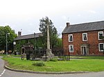
Westborough is a village in the civil parish of Westborough and Dry Doddington, in the South Kesteven district of Lincolnshire, England. It is situated 1 mile (1.6 km) east from the A1 road and Long Bennington, and 6 miles (10 km) north from Grantham. In 1921 the parish had a population of 132. On 1 April 1931 the parish was abolished and merged with Dry Doddington to form "Westborough and Dry Doddington". Nearby to the north is Dry Doddington. The Viking Way and River Witham pass through the village. The name 'Westborough' means 'west fortification'.The village Grade I listed Anglican church is dedicated to All Saints.
Excerpt from the Wikipedia article Westborough, Lincolnshire (License: CC BY-SA 3.0, Authors, Images).Westborough, Lincolnshire
Ease Lane, South Kesteven Westborough and Dry Doddington
Geographical coordinates (GPS) Address Nearby Places Show on map
Geographical coordinates (GPS)
| Latitude | Longitude |
|---|---|
| N 52.99438 ° | E -0.73252 ° |
Address
Ease Lane
Ease Lane
NG23 5HW South Kesteven, Westborough and Dry Doddington
England, United Kingdom
Open on Google Maps


