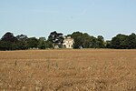
Westborough and Dry Doddington
Civil parishes in LincolnshireSouth Kesteven District

Westborough and Dry Doddington is a civil parish in the north-west of South Kesteven in the county of Lincolnshire. The population of the civil parish was 335 at the 2001 census increasing to 365 at the 2011 census.
Excerpt from the Wikipedia article Westborough and Dry Doddington (License: CC BY-SA 3.0, Authors, Images).Westborough and Dry Doddington
Main Street, South Kesteven Westborough and Dry Doddington
Geographical coordinates (GPS) Address Nearby Places Show on map
Geographical coordinates (GPS)
| Latitude | Longitude |
|---|---|
| N 53.011 ° | E -0.734 ° |
Address
Claypole Lane
Main Street
NG23 5HU South Kesteven, Westborough and Dry Doddington
England, United Kingdom
Open on Google Maps


