East Midlands

The East Midlands is one of nine official regions of England. It comprises the eastern half of the area traditionally known as the Midlands. It consists of Derbyshire, Leicestershire, Lincolnshire (except for North Lincolnshire and North East Lincolnshire), Northamptonshire, Nottinghamshire, and Rutland. The region has an area of 15,627 km2 (6,034 sq mi), with a population over 4.5 million in 2011. With a sufficiency-level world city ranking, Nottingham is the only settlement in the region to be classified by the Globalization and World Cities Research Network.The region is primarily served by East Midlands Airport, which lies between Derby, Leicester and Nottingham. The main cities in the region are Derby, Leicester, Lincoln and Nottingham. The largest towns in these counties are Boston, Chesterfield, Coalville, Corby, Glossop, Grantham, Kettering, Loughborough, Northampton, Mansfield, Oakham, Swadlincote and Wellingborough.
Excerpt from the Wikipedia article East Midlands (License: CC BY-SA 3.0, Authors, Images).East Midlands
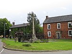
Main Road, South Kesteven Long Bennington
Geographical coordinates (GPS) Address Nearby Places Show on map
Geographical coordinates (GPS)
| Latitude | Longitude |
|---|---|
| N 52.98 ° | E -0.75 ° |
Address
Main Road
Main Road
NG23 5EU South Kesteven, Long Bennington
England, United Kingdom
Open on Google Maps


