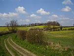
Stubton

Stubton is a small village and civil parish in the South Kesteven district of Lincolnshire, England. The population of the civil parish (including Fenton) at the 2011 census was 295. The village is situated 8 miles (13 km) north from Grantham and 5 miles (8 km) south-east from Newark-on-Trent in Nottinghamshire. Adjacent villages include Claypole, Dry Doddington, Beckingham and Brandon. The parish church is a Grade II* listed building dedicated to Saint Martin, built in 1799, with a chancel added in 1869.Stubton Hall is a large Grade II listed country house, built in 1813-14 by Sir Jeffry Wyatville for Sir Robert Heron, 2nd Baronet. In 1918 it was purchased by Sir Edmund Royds. After his death in 1946 it was purchased by Lincolnshire County Council, and from 1952 to 2003 it was used as a boarding school, and is now a hotel and wedding venue.
Excerpt from the Wikipedia article Stubton (License: CC BY-SA 3.0, Authors, Images).Stubton
South Kesteven Stubton
Geographical coordinates (GPS) Address Nearby Places Show on map
Geographical coordinates (GPS)
| Latitude | Longitude |
|---|---|
| N 53.030081 ° | E -0.69992 ° |
Address
NG23 5BX South Kesteven, Stubton
England, United Kingdom
Open on Google Maps


