place

Westport, Baltimore

African-American history in BaltimoreMaryland populated places on the Chesapeake BayNeighborhoods in BaltimorePoverty in MarylandWestport, Baltimore
Working-class culture in Baltimore
Westport, Baltimore, MD 21230, USA panoramio

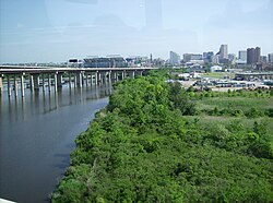
Westport is a neighborhood in south Baltimore, Maryland. Westport is a majority African-American neighborhood that has struggled with crime, housing abandonment, and unemployment in the past decade. The neighborhood is bordered by the Middle Branch of the Patapsco River on the east, the city neighborhoods of Cherry Hill, Brooklyn and the southwestern Baltimore County community of Lansdowne to the southwest, Hollins Ferry Road and the Mount Winans and Lakeland neighborhoods to the west, and Interstate 95 to the north, along with the South Baltimore communities of Federal Hill and Otterbein. The Baltimore–Washington Parkway (Maryland Route 295 — formerly Interstate 295) runs through the middle of Westport and intersects with Interstate 95, the main East Coast super-highway, north to south, Maine to Florida.

Excerpt from the Wikipedia article Westport, Baltimore (License: CC BY-SA 3.0, Authors, Images).

Westport, Baltimore
Annapolis Road, Baltimore

Geographical coordinates (GPS) Address Nearby Places
placeShow on map

Wikipedia: Westport, BaltimoreContinue reading on Wikipedia

Geographical coordinates (GPS)

Latitude Longitude
N 39.2629 ° E -76.6337 °
placeShow on map

Address

Annapolis Road 2301
21230 Baltimore
Maryland, United States
mapOpen on Google Maps

Westport, Baltimore, MD 21230, USA panoramio
Share experience

Nearby Places

Mount Winans, Baltimore

"Mount Winans" ("Mt. Winans") is a mixed-use residential, commercial and industrial neighborhood in the southwestern area of the City of Baltimore in Maryland. Its north, south and east boundaries are marked by the various lines of track of the CSX Railroad (formerly the historic Baltimore and Ohio Railroad before 1987, and later briefly, the "Chessie System"). In addition, Hollins Ferry Road running to the south towards suburban Baltimore County in the southwest and further connecting with adjacent Anne Arundel County to the southeast, draws its western boundary. The neighborhood was named after Ross Winans, (1796-1877), a famous inventor of railway steam engines for the old Baltimore and Ohio Railroad at its beginnings in 1828 and later other American lines when he later set up foundries and shops adjacent to the B. & O.'s "Mount Clare Shops" on West Pratt Street in the later named Mount Clare, Union Square and Poppleton neighborhoods of southwest Baltimore. Winans was also a major industrialist partnering with similar New York City inventor and industrialist Peter Cooper, who developed the first steam-powered locomotive for the Baltimore & Ohio, the famous "Tom Thumb" of 1830. Cooper and Winans later were involved in the southeast Baltimore industrial and port development beginning in the 1820s, further east of historic Fells Point, the earlier colonial-era and late 18th Century shipbuilding and trade district of the City. Along the northern shore of the Northwest Branch of the Patapsco River and Baltimore Harbor, the new district was titled "Canton", named for the famous southern Chinese city by the "Canton Company", founded by Capt. John O'Donnell and his descendants, a ship captain who returned in the 1780s and 90s with the first cargoes on Yankee merchant ships to Maryland from the new markets and trade in Asia.

Equitable Gas Works
Equitable Gas Works

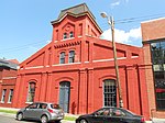
Equitable Gas Works is a historic gas works located at Baltimore, Maryland, United States. It is a U-shaped complex occupying an entire city block and consisting of five 1882-1883 Romanesque Revival painted brick buildings ranging from one to two stories in height and one 1947 office building adjacent to CSX tracks in Spring Gardens, an industrial precinct in South Baltimore, Maryland. The rectangular, 19 century buildings are set on semi-coursed stone foundations, and are topped with monitor and gable roofs. The buildings exhibit a recessed wall plane behind paired brick pilasters and corbelled brick cornices and oculus openings set within their gables. The Office is notable for its delicate wood louvered dormer with a sunburst- ornamented tympanum. The exposed structural system remains visible in the industrial buildings; historic finishes also survive in the office building. The architect for the building is not presently known. The period of gas production in the complex extends from 1882 to 1901, when gas-related uses abandoned the site. Despite infill and alterations, Equitable Gas Works complex retains all of its original brick buildings and remains clearly recognizable as a purpose-built, 19 century gas manufactory. Both the form and massing of the buildings and the quality and character of surviving architectural fabric provide important evidence of the stature of the manufactured gas industry in the late 19 century. Equitable Gas Works was listed on the National Register of Historic Places in 2003.