place

Carroll-Camden Industrial Area, Baltimore

Neighborhoods in BaltimoreSouthwest Baltimore
Carroll Camden Industrial Park sign Baltimore MD

Carroll-Camden Industrial Area is a neighborhood in southwest Baltimore, Maryland.

Excerpt from the Wikipedia article Carroll-Camden Industrial Area, Baltimore (License: CC BY-SA 3.0, Authors, Images).

Carroll-Camden Industrial Area, Baltimore
Bush Street, Baltimore Sowebo

Geographical coordinates (GPS) Address Nearby Places
placeShow on map

Wikipedia: Carroll-Camden Industrial Area, BaltimoreContinue reading on Wikipedia

Geographical coordinates (GPS)

Latitude Longitude
N 39.2726 ° E -76.6384 °
placeShow on map

Address

Bush Street
21230 Baltimore, Sowebo
Maryland, United States
mapOpen on Google Maps

Carroll Camden Industrial Park sign Baltimore MD
Share experience

Nearby Places

Equitable Gas Works
Equitable Gas Works

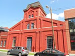
Equitable Gas Works is a historic gas works located at Baltimore, Maryland, United States. It is a U-shaped complex occupying an entire city block and consisting of five 1882-1883 Romanesque Revival painted brick buildings ranging from one to two stories in height and one 1947 office building adjacent to CSX tracks in Spring Gardens, an industrial precinct in South Baltimore, Maryland. The rectangular, 19 century buildings are set on semi-coursed stone foundations, and are topped with monitor and gable roofs. The buildings exhibit a recessed wall plane behind paired brick pilasters and corbelled brick cornices and oculus openings set within their gables. The Office is notable for its delicate wood louvered dormer with a sunburst- ornamented tympanum. The exposed structural system remains visible in the industrial buildings; historic finishes also survive in the office building. The architect for the building is not presently known. The period of gas production in the complex extends from 1882 to 1901, when gas-related uses abandoned the site. Despite infill and alterations, Equitable Gas Works complex retains all of its original brick buildings and remains clearly recognizable as a purpose-built, 19 century gas manufactory. Both the form and massing of the buildings and the quality and character of surviving architectural fabric provide important evidence of the stature of the manufactured gas industry in the late 19 century. Equitable Gas Works was listed on the National Register of Historic Places in 2003.

Pigtown, Baltimore
Pigtown, Baltimore

"Pigtown", also known as "Washington Village" is a neighborhood in the southwest area of Baltimore, bordered by Martin Luther King Jr. Boulevard to the east, Monroe Street to the west, Russell Street to the south, and West Pratt Street to the north. The neighborhood acquired its name during the second half of the 19th century, when the area was the site of butcher shops and meat packing plants to process pigs transported from the Midwest on the B&O Railroad; they were herded across Ostend and Cross Streets to be slaughtered and processed.Pigtown's annual festival famously features a pig race, called "The Squeakness", to commemorate its history.Pigtown has long been considered one of Baltimore's most promising neighborhoods due to its proximity to the I-95 corridor, the University of Maryland Medical Center, Camden Yards, Ravens Stadium, the Inner Harbor, and Downtown Baltimore. New developments on the eastern edge of the neighborhood of luxury townhomes were stalled after the 2008 market crash but eventually resumed and have continued into 2016. Other parts of the neighborhood contain classic Baltimore-style rowhouses, often with 1950s-era formstone facades on brick fronts. Pigtown has a relatively diverse population, which, besides its longtime residents, includes a sizeable graduate student population. Because of its proximity to Interstate 95, the Baltimore-Washington Parkway, MARC's Camden Station, and its low housing costs, Pigtown also has a great number of commuters to Washington, D.C., and Fort George G. Meade. The legendary baseball player Babe Ruth was born and raised in Pigtown.

Mount Winans, Baltimore

"Mount Winans" ("Mt. Winans") is a mixed-use residential, commercial and industrial neighborhood in the southwestern area of the City of Baltimore in Maryland. Its north, south and east boundaries are marked by the various lines of track of the CSX Railroad (formerly the historic Baltimore and Ohio Railroad before 1987, and later briefly, the "Chessie System"). In addition, Hollins Ferry Road running to the south towards suburban Baltimore County in the southwest and further connecting with adjacent Anne Arundel County to the southeast, draws its western boundary. The neighborhood was named after Ross Winans, (1796-1877), a famous inventor of railway steam engines for the old Baltimore and Ohio Railroad at its beginnings in 1828 and later other American lines when he later set up foundries and shops adjacent to the B. & O.'s "Mount Clare Shops" on West Pratt Street in the later named Mount Clare, Union Square and Poppleton neighborhoods of southwest Baltimore. Winans was also a major industrialist partnering with similar New York City inventor and industrialist Peter Cooper, who developed the first steam-powered locomotive for the Baltimore & Ohio, the famous "Tom Thumb" of 1830. Cooper and Winans later were involved in the southeast Baltimore industrial and port development beginning in the 1820s, further east of historic Fells Point, the earlier colonial-era and late 18th Century shipbuilding and trade district of the City. Along the northern shore of the Northwest Branch of the Patapsco River and Baltimore Harbor, the new district was titled "Canton", named for the famous southern Chinese city by the "Canton Company", founded by Capt. John O'Donnell and his descendants, a ship captain who returned in the 1780s and 90s with the first cargoes on Yankee merchant ships to Maryland from the new markets and trade in Asia.