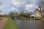
Kamerik-Houtdijken
1818 establishments in the NetherlandsFormer municipalities of Utrecht (province)Utrecht (province) geography stubs
Kamerik-Houtdijken is a former municipality in the Dutch province of Utrecht. It existed from 1818 to 1857, after which it merged with 's-Gravesloot, Kamerik-Mijzijde, and Teckop, to form the new municipality of Kamerik.During that time, it had about 620 inhabitants, in three polders: Kamerik-Teylingens, Groot-Houtdijk, and Klein-Houtdijk. This included the village of Oud-Kamerik, the hamlet Houtdijken, and half of the village of Kamerik.
Excerpt from the Wikipedia article Kamerik-Houtdijken (License: CC BY-SA 3.0, Authors).Kamerik-Houtdijken
Houtdijkerpad,
Geographical coordinates (GPS) Address Nearby Places Show on map
Geographical coordinates (GPS)
| Latitude | Longitude |
|---|---|
| N 52.109036 ° | E 4.912262 ° |
Address
Houtdijkerpad
Houtdijkerpad
3471 BT
Utrecht, Netherlands
Open on Google Maps


