's-Gravesloot

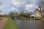
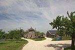
's-Gravesloot is a former hamlet and municipality in the Dutch province of Utrecht. It was located between Kamerik and Woerden. 's-Gravesloot was a heerlijkheid (manor) owned by the province of Utrecht until 1751, when it was sold to a private owner. When the current municipal system was introduced in the Netherlands in 1812, it became part of Kamerik. When that municipality was split into three parts, 's-Gravesloot became a separate municipality again. In 1857, Kamerik-Mijzijde, Kamerik-Houtdijken, and 's-Gravesloot merged again, to form the new municipality of Kamerik. Kamerik and 's-Gravesloot are now part of Woerden.The municipality of 's-Gravesloot consisted of a polder with the same name, covered an area of 3.23 km2, and contained the hamlet of 's-Gravesloot. It had a population of about 110.
Excerpt from the Wikipedia article 's-Gravesloot (License: CC BY-SA 3.0, Authors, Images).'s-Gravesloot
's-Gravensloot,
Geographical coordinates (GPS) Address Nearby Places Show on map
Geographical coordinates (GPS)
| Latitude | Longitude |
|---|---|
| N 52.095 ° | E 4.8791666666667 ° |
Address
's-Gravensloot 20
3471 BN
Utrecht, Netherlands
Open on Google Maps


