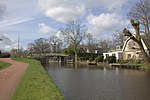
Kamerik

Kamerik is a village in the Dutch province of Utrecht. It is a part of the municipality of Woerden and is situated about 3 km north of Woerden. In 2010 the village of Kamerik (including Kanis) had 3808 inhabitants. The built-up area of the town was 0.43 km² and contained 877 residences. The statistical district "Kamerik and Kanis", which includes two villages and the surrounding countryside, has a population of around 3050. This does not include the separate villages of Kamerik-Mijzijde and Oud-Kamerik. Until it was merged with Woerden in 1989 Kamerik was a separate municipality. Between 1818 and 1857 it was split into two municipalities: Kamerik-Mijzijde on the west side, and Kamerik-Houtdijken on the east.
Excerpt from the Wikipedia article Kamerik (License: CC BY-SA 3.0, Authors, Images).Kamerik
Park Mijzijde,
Geographical coordinates (GPS) Address Nearby Places Show on map
Geographical coordinates (GPS)
| Latitude | Longitude |
|---|---|
| N 52.110833333333 ° | E 4.8927777777778 ° |
Address
Park Mijzijde
Park Mijzijde
3471 AA
Utrecht, Netherlands
Open on Google Maps


