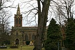
Bunny, Nottinghamshire
EngvarB from May 2016Nottinghamshire geography stubsRushcliffeVillages in Nottinghamshire
Bunny is a village and civil parish located in the Rushcliffe borough of Nottinghamshire, England. The parish has a population of around 600, measured at 689 in the 2011 Census. It is on the A60, 7 miles (11 km) south of Nottingham, south of Bradmore and north of Costock.
Excerpt from the Wikipedia article Bunny, Nottinghamshire (License: CC BY-SA 3.0, Authors).Bunny, Nottinghamshire
Church Street, Rushcliffe
Geographical coordinates (GPS) Address Nearby Places Show on map
Geographical coordinates (GPS)
| Latitude | Longitude |
|---|---|
| N 52.8608 ° | E -1.1358 ° |
Address
Church Street
NG11 6QW Rushcliffe
England, United Kingdom
Open on Google Maps


