place

George Tavern

Grade II listed buildings in the London Borough of Tower HamletsGrade II listed pubs in LondonMusic venues in LondonPubs in the London Borough of Tower HamletsStepney
Use British English from August 2012
The George Tavern 373 Commercial Road, London

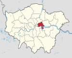
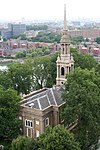
The George Tavern is a Grade II listed public house and music venue located on Commercial Road in Stepney, London. It is owned and operated by artist Pauline Forster. Formerly known as the Halfway House, the building contains original brickwork some 700 years old, and is mentioned in texts by Geoffrey Chaucer, Samuel Pepys and Charles Dickens. In 2002, artist Pauline Forster bought the derelict building at auction and has reopened it as a music, performance and arts venue, and pub. It is also a popular location for photo, film, and video shoots.

Excerpt from the Wikipedia article George Tavern (License: CC BY-SA 3.0, Authors, Images).

George Tavern
Commercial Road, London Shadwell

Geographical coordinates (GPS) Address External links Nearby Places
placeShow on map

Wikipedia: George TavernContinue reading on Wikipedia

Geographical coordinates (GPS)

Latitude Longitude
N 51.5143 ° E -0.053 °
placeShow on map

Address

The George Tavern

Commercial Road 373
E1 0LA London, Shadwell
England, United Kingdom
mapOpen on Google Maps

linkWikiData (Q5545090)
linkOpenStreetMap (195649317)

The George Tavern 373 Commercial Road, London
Share experience

Nearby Places

East End of London
East End of London

The East End of London, often referred to within the London area simply as the East End, is the historic core of wider East London, east of the Roman and medieval walls of the City of London and north of the River Thames. It does not have universally accepted boundaries to the north and east, though the River Lea is sometimes seen as the eastern boundary. Parts of it may be regarded as lying within Central London (though that term too has no precise definition). The term "East of Aldgate Pump" is sometimes used as a synonym for the area. The East End began to emerge in the Middle Ages with initially slow urban growth outside the eastern walls, which later accelerated, especially in the 19th century, to absorb pre-existing settlements. The first known written record of the East End as a distinct entity, as opposed to its component parts, comes from John Strype's 1720 Survey of London, which describes London as consisting of four parts: the City of London, Westminster, Southwark, and "That Part beyond the Tower". The relevance of Strype's reference to the Tower was more than geographical. The East End was the urbanised part of an administrative area called the Tower Division, which had owed military service to the Tower of London since time immemorial. Later, as London grew further, the fully urbanised Tower Division became a byword for wider East London, before East London grew further still, east of the River Lea and into Essex. The area was notorious for its deep poverty, overcrowding and associated social problems. This led to the East End's history of intense political activism and association with some of the country's most influential social reformers. Another major theme of East End history has been migration, both inward and outward. The area had a strong pull on the rural poor from other parts of England, and attracted waves of migration from further afield, notably Huguenot refugees, Irish weavers, Ashkenazi Jews and in the 20th century, Sylhetis. The closure of the last of the Port of London's East End docks in 1980 created further challenges and led to attempts at regeneration, with Canary Wharf and the Olympic Park among the most successful examples. While some parts of the East End are undergoing rapid change, the area continues to contain some of the worst poverty in Britain.

Shadwell & St. George's East railway station

Shadwell was a railway station in the parish of St. George in the East, London, that was opened by the Commercial Railway (later the London and Blackwall Railway). It was situated 50 yards to the east of the current Shadwell DLR station on the Docklands Light Railway, with the former station entrance on Sutton Street (Shadwell DLR's entrance is on Watney Street). The former station was between Cannon Street Road and Stepney (now called Limehouse), and was 1 mile 5 chains (1.7 km) down-line from Fenchurch Street.Shadwell opened in October 1840, three months after the opening of the rest of the Commercial Railway, which rebranded as the LBR in 1841. It was eventually incorporated into the London, Tilbury and Southend Railway (LTSR) and was rebuilt in 1895 when the railway was widened to four tracks; Shadwell only served the slow lines on the south side. In 1900, the station was renamed Shadwell & St. George's East, possibly to distinguish it from the East London Railway (ELR) station of the same name. Apart from a wartime closure between 1916 and 1919, Shadwell & St. George's East remained open until July 1941, when dwindling passenger numbers forced its then owner, the London and North Eastern Railway, to close both it and Leman Street station. Some remains of the station can still be seen today: the westbound platform has partially survived although it is somewhat dilapidated, and the red brick station entrance on Sutton Street still survives. The Docklands Light Railway Shadwell station has been built partly on the site of the station.

London Borough of Tower Hamlets

The London Borough of Tower Hamlets is a London borough covering much of the traditional East End. It was formed in 1965 from the merger of the former metropolitan boroughs of Stepney, Poplar, and Bethnal Green. 'Tower Hamlets' was originally an alternative name for the historic Tower Division; the area of south-east Middlesex, focused on (but not limited to) the area of the modern borough, which owed military service to the Tower of London. The borough lies on the north bank of the River Thames immediately east of the City of London, and includes much of the redeveloped Docklands area. Some of the tallest buildings in London occupy the centre of the Isle of Dogs in the south of the borough. A part of the Queen Elizabeth Olympic Park is in Tower Hamlets. The 2019 mid-year population for the borough is estimated at 324,745. Asian/Asian British Bangladeshis at 32% form the largest ethnic group. The 2011 census showed Tower Hamlets to have the highest proportion of Muslims of any English local authority and that Muslims outnumbered Christians. The borough has more than forty mosques and Islamic centres, including the East London Mosque, one of Britain's largest. Brick Lane's restaurants, neighbouring street market and shops provide the largest range of Bengali cuisine, woodwork, carpets and clothes in Europe. The Lane is also a major centre of hipster subculture.In 2017 a joint study by Trust for London and New Policy Institute found Tower Hamlets to be the 2nd most deprived London borough (after Barking and Dagenham) based on an average calculated across a range of indicators; with high rates of poverty, child poverty, unemployment and pay inequality compared to other London boroughs. However, it has the lowest gap for educational outcomes at secondary level.The local authority is Tower Hamlets London Borough Council.

Siege of Sidney Street

The siege of Sidney Street of January 1911, also known as the Battle of Stepney, was a gunfight in the East End of London between a combined police and army force and two Latvian revolutionaries. The siege was the culmination of a series of events that began in December 1910, with an attempted jewellery robbery at Houndsditch in the City of London by a gang of Latvian immigrants which resulted in the murder of three policemen, the wounding of two others, and the death of George Gardstein, the leader of the Latvian gang. An investigation by the Metropolitan and City of London Police forces identified Gardstein's accomplices, most of whom were arrested within two weeks. The police were informed that the last two members of the gang were hiding at 100 Sidney Street in Stepney. The police evacuated local residents, and on the morning of 3 January a firefight broke out. Armed with inferior weapons, the police sought assistance from the army. The siege lasted for about six hours. Towards the end of the stand-off, the building caught fire; no single cause has been identified. One of the agitators in the building was shot before the fire spread. While the London Fire Brigade were damping down the ruins—in which they found the two bodies—the building collapsed, killing a fireman. The siege marked the first time the police had requested military assistance in London to deal with an armed stand-off. It was also the first siege in Britain to be caught on camera, as the events were filmed by Pathé News. Some of the footage included images of the Home Secretary, Winston Churchill. His presence caused a political row over the level of his operational involvement. At the trial in May 1911 of those arrested for the Houndsditch jewellery robbery, all but one of the accused were acquitted; the conviction was overturned on appeal. The events were fictionalised in film—in The Man Who Knew Too Much (1934) and The Siege of Sidney Street (1960)—and novels. On the centenary of the events two tower blocks in Sidney Street were named after Peter the Painter, one of the minor members of the gang who was probably not present at either Houndsditch or Sidney Street. The murdered policemen and the fireman who died are commemorated with memorial plaques.