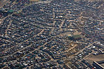
Nyanga, Western Cape

Nyanga is a township in the Western Cape, South Africa. Its name in Xhosa means "moon" and it is one of the oldest black townships in Cape Town. It was established as a result of the migrant labour system. In 1948 black migrants were forced to settle in Nyanga as Langa had become too small. Nyanga was one of the poorest places in Cape Town and is still is one of the most dangerous parts of Cape Town. In 2001 its unemployment rate was estimated at being approximately 56% and HIV/AIDS is a huge community issue. Nyanga is situated 20 km (12 mi) from Cape Town along the N2 highway, close to the Cape Town International Airport and next to the townships of Gugulethu and Crossroads.
Excerpt from the Wikipedia article Nyanga, Western Cape (License: CC BY-SA 3.0, Authors, Images).Nyanga, Western Cape
Klipfontein Road,
Geographical coordinates (GPS) Address Nearby Places Show on map
Geographical coordinates (GPS)
| Latitude | Longitude |
|---|---|
| N -33.983333333333 ° | E 18.583333333333 ° |
Address
Klipfontein Road
Klipfontein Road
7490 , Nyanga
Western Cape, South Africa
Open on Google Maps


