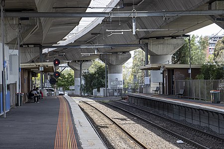
Macaulay railway station

Macaulay railway station is located on the Upfield line in Victoria, Australia. It serves the inner northern Melbourne suburb of North Melbourne, and it opened on 1 December 1887 as Macaulay Road. It was renamed Macaulay on 1 May 1909.The station is located beside the Moonee Ponds Creek to its west, and surrounded mainly by factories and warehouses. Kensington, on the Craigieburn line, is only 400 m (1,300 ft) west of Macaulay, and is significantly closer to the residential area and handles a larger number of commuters. The station is also located at ground level, beneath the CityLink tollway, which is supported atop concrete columns that are located outside the platform fencing.
Excerpt from the Wikipedia article Macaulay railway station (License: CC BY-SA 3.0, Authors, Images).Macaulay railway station
CityLink, Melbourne North Melbourne
Geographical coordinates (GPS) Address External links Nearby Places Show on map
Geographical coordinates (GPS)
| Latitude | Longitude |
|---|---|
| N -37.7946 ° | E 144.9362 ° |
Address
Macaulay
CityLink
3031 Melbourne, North Melbourne
Victoria, Australia
Open on Google Maps


