Swingfield
Civil parishes in KentCommons category link is locally definedVillages in Kent

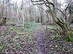
Swingfield is a village and civil parish in the district of Folkestone and Hythe in Kent, England. The parish includes the settlements of Densole on the A260 towards Hawkinge, and Selsted. The village is located approximately 5 miles north of Folkestone on the North Downs. Notable buildings include St Peter's Church and Swingfield Preceptory.
Excerpt from the Wikipedia article Swingfield (License: CC BY-SA 3.0, Authors, Images).Swingfield
Folkestone and Hythe District
Geographical coordinates (GPS) Address Nearby Places Show on map
Geographical coordinates (GPS)
| Latitude | Longitude |
|---|---|
| N 51.1464 ° | E 1.18972 ° |
Address
CT15 7EZ Folkestone and Hythe District
England, United Kingdom
Open on Google Maps


