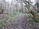
Swingfield Preceptory
English Heritage sites in KentKent building and structure stubsMonasteries in KentUnited Kingdom Christian monastery stubs

Swingfield Preceptory (or St John's Commandery, Swingfield) was a priory about 5 miles north of Folkestone, Kent on the south coast of England.
Excerpt from the Wikipedia article Swingfield Preceptory (License: CC BY-SA 3.0, Authors, Images).Swingfield Preceptory
Stockham Lane, Folkestone and Hythe District
Geographical coordinates (GPS) Address External links Nearby Places Show on map
Geographical coordinates (GPS)
| Latitude | Longitude |
|---|---|
| N 51.1518 ° | E 1.1906 ° |
Address
St John's Commandery
Stockham Lane
CT15 7QG Folkestone and Hythe District
England, United Kingdom
Open on Google Maps


