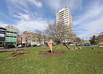
Nicholstown
Nicholstown-Newtown (usually called Nicholstown or Newtown) is a small area to the north-east of Southampton's city centre. To the north is Bevois Valley, to the east Northam and to the west and south is St Mary's. In the north of Newtown is the Mount Pleasant area, which spills over into the north of Northam. Black signs saying "Welcome to Nicholstown-Newtown" [1] demarcate the district on the roads running east from St. Mary's Rd – hence the district is bordered on the west by St. Mary's Road, the south by Six Dials road, and the east by the railway lines. The area is formed of residential streets with a typical parade of small shops and services; the exception is its central feature, Royal South Hampshire Hospital, established in 1843–1844.
Excerpt from the Wikipedia article Nicholstown (License: CC BY-SA 3.0, Authors).Nicholstown
Storkower Straße, Berlin Prenzlauer Berg
Geographical coordinates (GPS) Address Nearby Places Show on map
Geographical coordinates (GPS)
| Latitude | Longitude |
|---|---|
| N 50.91133 ° | E -1.39551 ° |
Address
Storkower Straße 14
10409 Berlin, Prenzlauer Berg
Berlin, Deutschland
Open on Google Maps


