St Mary's, Southampton

St Mary's is an inner city area of Southampton in England. It consists of two areas separated by Six Dials junction. The northern section of the district is bounded by St Mary's Road and some streets to the west and the area to the east is Nicholstown-Newtown. The northern section is home to the fire station.The majority of St Mary's is in the southern portion, to the east of St Mary Street. This is where St Mary's church is located, from which the suburb's name originates. The southern section is also home to the Golden Grove area. It is bordered on the east by the rail lines (the other side of these lines is the district of Chapel). It gives its name to St Mary's Stadium, where Southampton Football Club play, although the stadium itself is in the neighbouring suburb of Northam.
Excerpt from the Wikipedia article St Mary's, Southampton (License: CC BY-SA 3.0, Authors, Images).St Mary's, Southampton
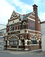
St Mary Street, Southampton St Mary's
Geographical coordinates (GPS) Address Nearby Places Show on map
Geographical coordinates (GPS)
| Latitude | Longitude |
|---|---|
| N 50.9056 ° | E -1.3965 ° |
Address
Atlantic dry cleaning
St Mary Street
SO14 1NR Southampton, St Mary's
England, United Kingdom
Open on Google Maps


