Paddington Waterside
Buildings and structures in the City of WestminsterCentral business districts in the United KingdomPaddingtonPrivately owned public spacesRedeveloped ports and waterfronts in London ... and 2 more
Redevelopment projects in LondonUse British English from December 2016

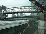
Paddington Waterside is a developed area around Paddington Station in London. The Paddington Special Policy Area covers a region almost the size of Soho, creating about 10,000,000 square feet (930,000 m2) of space between 1998 and 2018. Coordinated by the Paddington Waterside Partnership, it consists of 13 individual projects in the triangle of land between Praed Street, Westbourne Terrace and the A40 Westway, most notably PaddingtonCentral and Paddington Basin. In 2000, The Independent described it as "the largest central London redevelopment scheme since the Second World War".
Excerpt from the Wikipedia article Paddington Waterside (License: CC BY-SA 3.0, Authors, Images).Paddington Waterside
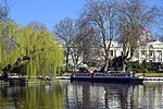
Grand Union Canal (Paddington Arm) towpath, London Paddington
Geographical coordinates (GPS) Address Phone number Website Nearby Places Show on map
Geographical coordinates (GPS)
| Latitude | Longitude |
|---|---|
| N 51.518611111111 ° | E -0.17777777777778 ° |
Address
Darcie & May Green
Grand Union Canal (Paddington Arm) towpath
W2 6EP London, Paddington
England, United Kingdom
Open on Google Maps


