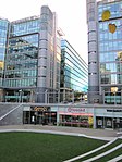
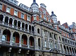
Marylebone Road

Marylebone Road ( (listen) MAR-li-bən) is an important thoroughfare in central London, within the City of Westminster. It runs east–west from the Euston Road at Regent's Park to the A40 Westway at Paddington. The road which runs in three lanes in both directions, is part of the London Inner Ring Road and as such forms part of the boundary of the zone within which the London congestion charge applies. As part of the ring road and a feeder route to the A40 (and hence the M40 motorway) (to the west) and the A5 and M1 motorway (to the north) much of the traffic leaving central London for the Midlands and the North of England travels on this road. It is frequently heavily congested.
Excerpt from the Wikipedia article Marylebone Road (License: CC BY-SA 3.0, Authors, Images).Marylebone Road
Westway, City of Westminster Paddington
Geographical coordinates (GPS) Address Nearby Places Show on map
Geographical coordinates (GPS)
| Latitude | Longitude |
|---|---|
| N 51.52 ° | E -0.175 ° |
Address
Westway (Marylebone Flyover)
Westway
W2 1AR City of Westminster, Paddington
England, United Kingdom
Open on Google Maps


