Mydroilyn
Ceredigion geography stubsVillages in Ceredigion

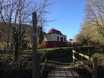
Mydroilyn is a village in the parish of Llanarth, Ceredigion, Wales, situated along the B4342 road. The name of the village is derived from the confluence of the Mydr and the Oilyn; two streams in the village. Of particular note, is the 200-year-old farmhouse Aelybryn, which once belonged to a Welsh landowner, the Anglican Holy Trinity Church, the Mydroilyn Independent Chapel, dated to 1898 by David Davies, the Y Ficar Wesleyan Chapel, dated to 1849, and the small 19th century corn-mill named Y Felin.
Excerpt from the Wikipedia article Mydroilyn (License: CC BY-SA 3.0, Authors, Images).Mydroilyn
B4342,
Geographical coordinates (GPS) Address Nearby Places Show on map
Geographical coordinates (GPS)
| Latitude | Longitude |
|---|---|
| N 52.17474 ° | E -4.25823 ° |
Address
B4342
SA48 7QY , Llanarth
Wales, United Kingdom
Open on Google Maps


