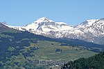
Riseten Pass
Canton of Glarus geography stubsCanton of St. Gallen geography stubsGlarus–St. Gallen borderMountain passes of SwitzerlandMountain passes of the Alps ... and 2 more
Mountain passes of the canton of GlarusMountain passes of the canton of St. Gallen
The Riseten Pass (German: Risetenpass) is a mountain pass of the Glarus Alps, located on the border between the Swiss cantons of St. Gallen and Glarus, at an elevation of 2,189 m (7,182 ft). It crosses the col between the peaks of the Wissgandstöckli and Foostock.The pass is traversed by a trail, which connects the village of Weisstannen, in the canton of St. Gallen at an elevation of 1,004 m (3,294 ft), with the valley of the Krauch stream and thence with the village of Matt, in the canton of Glarus at an elevation of 831 m (2,726 ft).
Excerpt from the Wikipedia article Riseten Pass (License: CC BY-SA 3.0, Authors).Riseten Pass
Siezerstrasse,
Geographical coordinates (GPS) Address Nearby Places Show on map
Geographical coordinates (GPS)
| Latitude | Longitude |
|---|---|
| N 46.978055555556 ° | E 9.2466666666667 ° |
Address
Risetenpass
Siezerstrasse
St. Gallen, Switzerland
Open on Google Maps


