place

Piz Segnas

Alpine three-thousandersCanton of Glarus geography stubsFlimsGlarus thrustGlarus–Graubünden border
Graubünden mountain stubsMountains of GraubündenMountains of SwitzerlandMountains of the AlpsMountains of the canton of Glarus
Piz Segnas
Piz Segnas

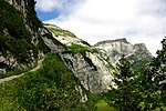
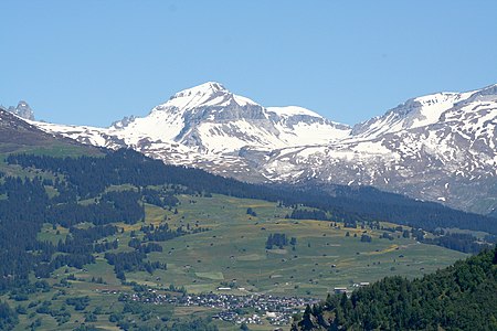
Piz Segnas is a mountain in the Glarus Alps, located on the border between the cantons of Glarus and Graubünden. Piz Sardona is on the same ridge to the north, from where the Trinserhorn or Piz Dolf lies to the southeast. The Tschingelhoerner with the famous Martinsloch (hole of St.Martin) lies to the west, with the Pass dil Segnas between the two mountains.The mountain lies in the municipalities of Flims, in the canton of Graubünden, and Glarus Süd, in the canton of Glarus. The nearest settlements are the villages of Flims, to the south, and Elm, to the west. A path crosses the Pass dil Segnas between the two villages. The easiest access to the area is an aerial cableway to Fil de Cassons (not active since 2015)from Flims or the hike to this ridge lying southeast of Piz Segnas.On 4 August 2018, a Junkers Ju 52 aircraft, operating a sightseeing flight, crashed into the western flank of the mountain, killing all 20 persons aboard.

Excerpt from the Wikipedia article Piz Segnas (License: CC BY-SA 3.0, Authors, Images).

Piz Segnas
Glarus Süd

Geographical coordinates (GPS) Address Nearby Places
placeShow on map

Wikipedia: Piz SegnasContinue reading on Wikipedia

Geographical coordinates (GPS)

Latitude Longitude
N 46.907916666667 ° E 9.2395833333333 °
placeShow on map

Address

Falzüber


Glarus Süd
Glarus, Switzerland
mapOpen on Google Maps

Piz Segnas
Piz Segnas
Share experience

Nearby Places

Fil de Cassons
Fil de Cassons

Fil de Cassons (also known as Cassonsgrat) is a mountain in the Glarus Alps, located near Flims in the canton of Graubünden, Switzerland. The southern face is referred to as "Flimserstein", dominating the appearance of the town of Flims. In its east lies Bargis from where a valley leads to its north face, while to its western face the sliding surface tears off of the biggest visible landslide in the world, Flims Rockslide. Piz Dolf is lying to the north across the Bargis valley, and to its west Piz Segnas, both showing the tectonic line of the Glarus thrust in its upper part, a now UNESCO world heritage. The easiest access to Fil de Cassons is an aerial cableway from Flims to this ridge, that actually allows also walks and an alpine experience from the cablecar for people that would not dare to walk a steep mountain path. Walking on top you will easily identify the tectonic line under your feet, as rocks turn from greenish to bright light grey on top of the wide ridge. For hikers aiming for more than a walk, several routes reach the high plateau and the very wide ridge, among them a historic Via Ferrata called Pinut. One hiking route uses the ascent via Val Bargis and Scala Mola, the path that the cows are being sent up to graze in summer. If you stay at the base of the valley of Bargis, you will hike on a path leading more or less around Fil de Cassons from east to northwest before reaching its top.Being a ridge, there is very often hardly snow, allowing walks even in winter along at least one mile on Fil de Cassons.

Rockslide of Elm
Rockslide of Elm

The rockslide of Elm (German: Der Bergsturz von Elm) was a mining disaster in Elm, Canton of Glarus, Switzerland which killed 115 people and destroyed 83 buildings on September 11, 1881. The catastrophe was partially caused by the mining of slate, beginning after 1870, by impoverished farmers who sought an additional source of income. Being inexperienced with proper mining techniques, they destabilized the rock face until the final catastrophe. The miners undercut the mountain face to a breadth of 180 m, and already in 1878 first rock movements occurred. A geological commission to examine the increasing number of rockfalls visited the scene shortly before the catastrophe, but did not find any indications of an impending disaster. The loud noise of the rockfalls, break-offs and fractures were already heard during the Sunday service on the morning of September 11, 1881. In spite of this, next to nobody left the dangerous area – in fact, many spectators went to the affected area or climbed to the nearby hamlet Düniberg on the opposing face of the valley in the hope of enjoying a better view of the spectacle. In the late afternoon, after two smaller rock slides, 10 million cubic meters (353 million cubic feet) of slate broke off, travelled 2 km (1.2 mi), and destroyed 90 hectares (220 acres) of land. The slate mine was also completely destroyed. The event and its causes were chronicled in the same year by the local priest Ernst Buss and the geologist Albert Heim in their publication "Der Bergsturz von Elm".