place

Piz Dolf

Alpine three-thousandersCanton of St. Gallen geography stubsFlimsGlarus thrustGraubünden mountain stubs
Graubünden–St. Gallen borderMountains of GraubündenMountains of SwitzerlandMountains of the AlpsMountains of the canton of St. GallenSwitzerland mountain stubsTrinWorld Heritage Sites in Switzerland
Hiking Switzerland Piz Dolf from Fil de Cassons

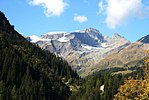
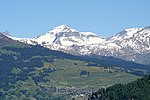
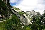
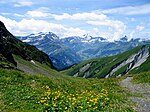
Piz Dolf (Romansh) or Trinserhorn (German) is a mountain of the Glarus Alps, located on the border between the cantons of St. Gallen and Graubünden. Piz Sardona is to the north across a glacier, and to its west Piz Segnas. Both Piz Segnas and Piz Dolf show the line of the Glarus thrust in its upper part. The easiest access to the area is an aerial cableway to Fil de Cassons from Flims or any of various hikes to this ridge lying southeast of Piz Dolf. One route uses the ascent via Val Bargis (the path can be seen on the picture (right) crossing the southern face of Piz Dolf in vegetation).

Excerpt from the Wikipedia article Piz Dolf (License: CC BY-SA 3.0, Authors, Images).

Geographical coordinates (GPS)

Latitude Longitude
N 46.903194444444 ° E 9.2666388888889 °
placeShow on map

Address

Flims


Grisons, Switzerland
mapOpen on Google Maps

Website
flims.com

linkVisit website

Hiking Switzerland Piz Dolf from Fil de Cassons
Share experience

Nearby Places

Fil de Cassons
Fil de Cassons

Fil de Cassons (also known as Cassonsgrat) is a mountain in the Glarus Alps, located near Flims in the canton of Graubünden, Switzerland. The southern face is referred to as "Flimserstein", dominating the appearance of the town of Flims. In its east lies Bargis from where a valley leads to its north face, while to its western face the sliding surface tears off of the biggest visible landslide in the world, Flims Rockslide. Piz Dolf is lying to the north across the Bargis valley, and to its west Piz Segnas, both showing the tectonic line of the Glarus thrust in its upper part, a now UNESCO world heritage. The easiest access to Fil de Cassons is an aerial cableway from Flims to this ridge, that actually allows also walks and an alpine experience from the cablecar for people that would not dare to walk a steep mountain path. Walking on top you will easily identify the tectonic line under your feet, as rocks turn from greenish to bright light grey on top of the wide ridge. For hikers aiming for more than a walk, several routes reach the high plateau and the very wide ridge, among them a historic Via Ferrata called Pinut. One hiking route uses the ascent via Val Bargis and Scala Mola, the path that the cows are being sent up to graze in summer. If you stay at the base of the valley of Bargis, you will hike on a path leading more or less around Fil de Cassons from east to northwest before reaching its top.Being a ridge, there is very often hardly snow, allowing walks even in winter along at least one mile on Fil de Cassons.