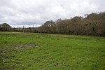
Lane End, Buckinghamshire
Civil parishes in BuckinghamshireVillages in Buckinghamshire
Lane End is a village and civil parish in Buckinghamshire, England. It is just south of the M40 from High Wycombe, about 2 miles (3.2 km) west of Booker. The village is twinned with Saint-Pierre-d'Oléron in France. The village is situated in the Chilterns, around 650 feet (200 m) above sea level, in rolling hills of farmland, beech woods and footpaths. The civil parish includes the hamlets of Cadmore End, Ditchfield, Moor Common and Moor End, and had a population of 3,583 at the 2001 Census.
Excerpt from the Wikipedia article Lane End, Buckinghamshire (License: CC BY-SA 3.0, Authors).Lane End, Buckinghamshire
Beech Avenue,
Geographical coordinates (GPS) Address Nearby Places Show on map
Geographical coordinates (GPS)
| Latitude | Longitude |
|---|---|
| N 51.622757 ° | E -0.829068 ° |
Address
Beech Avenue 4
HP14 3EQ , Lane End
England, United Kingdom
Open on Google Maps


