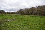
Frieth
Frieth is a village in the parish of Hambleden, in Buckinghamshire, England. It lies on the top of "Frieth Hill", which is part of the chalk escarpments of the Chiltern Hills. Frieth lies at a height of around 550 feet (170 m), on the edge of a broad and deep winterbourne chalk valley in which are located the older settlements of the parish and adjacent parishes – Hambleden, Skirmett, Turville, and Fingest. Because of the shortage of surface water and the relatively poor soils – heavy clay and flint overlaying the permeable chalk – Frieth did not develop into a village until well into Victorian times. However, there are a number of ancient properties and Frieth has all the symbols of a traditional English village. As well as the church, it has a village hall, a village green, two rural pubs, a village society, fine open hilly countryside, and a small but thriving primary school. The village shop and dairy has closed.
Excerpt from the Wikipedia article Frieth (License: CC BY-SA 3.0, Authors).Frieth
Church Road,
Geographical coordinates (GPS) Address Nearby Places Show on map
Geographical coordinates (GPS)
| Latitude | Longitude |
|---|---|
| N 51.604962 ° | E -0.8483 ° |
Address
Church Road
Church Road
RG9 6PL , Hambleden
England, United Kingdom
Open on Google Maps


