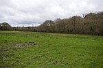
Bolter End
Buckinghamshire geography stubsHamlets in BuckinghamshireUse British English from August 2014

Bolter End is a hamlet 5 mi (8.0 km) to the west of High Wycombe in Buckinghamshire, England. Bolter End lies on the B482 road that connects Stokenchurch and Marlow between Cadmore End and Lane End and where it is crossed by the Piddington to Fingest road. Bolter End is part of Lane End (Where the population was included) civil parish and is within Wycombe district. Bolter End Sand Pit is a Site of Special Scientific Interest.
Excerpt from the Wikipedia article Bolter End (License: CC BY-SA 3.0, Authors, Images).Bolter End
Bolter End Lane,
Geographical coordinates (GPS) Address Nearby Places Show on map
Geographical coordinates (GPS)
| Latitude | Longitude |
|---|---|
| N 51.623333333333 ° | E -0.84944444444444 ° |
Address
Bolter End Lane
Bolter End Lane
HP14 3LU , Lane End
England, United Kingdom
Open on Google Maps


