place

Port of Paulsboro

1917 establishments in New JerseyDelaware RiverDelaware ValleyEconomy of New JerseyEnergy infrastructure in New Jersey
Foreign trade zones of the United StatesGeography of Gloucester County, New JerseyOil refineries in the United StatesPaulsboro, New JerseyPetroleum infrastructure in the United StatesPorts and harbors of New JerseyRedeveloped ports and waterfronts in the United StatesRiver ports of the United StatesSouth Jersey Port CorporationTransportation in Gloucester County, New JerseyWater transportation in New JerseyWind power in New Jersey

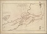
The Port of Paulsboro is located on the Delaware River and Mantua Creek in and around Paulsboro, in Gloucester County, New Jersey, United States, approximately 78 miles (126 km) from the Atlantic Ocean. Traditionally one of the nation's busiest for marine transfer operations, notably for crude oil and petroleum products, such as jet fuel and asphalt, it is a port of entry with several facilities within a foreign trade zone. A part of the port is being redeveloped as an adaptable deep water omniport able to handle a variety of bulk and break bulk cargo, as well as shipping containers. The Paulsboro Marine Terminal, as it is known, is owned by the South Jersey Port Corporation and operated by Holt Logistics. The first ship to call at the port, the Doric Warrior, carrying steel for NLMK, arrived March 3, 2017, marking the opening of the new facility. The port could become the site for the production the monopile foundations for turbines for the off-shore wind farm Ocean Wind.

Excerpt from the Wikipedia article Port of Paulsboro (License: CC BY-SA 3.0, Authors).

Port of Paulsboro
Mantua Avenue,

Geographical coordinates (GPS) Address Nearby Places
placeShow on map

Wikipedia: Port of PaulsboroContinue reading on Wikipedia

Geographical coordinates (GPS)

Latitude Longitude
N 39.852 ° E -75.235 °
placeShow on map

Address

BP Paulsboro Marine Terminal Groundwater Treatment Plant

Mantua Avenue
08066
New Jersey, United States
mapOpen on Google Maps

Share experience

Nearby Places

Tinicum Island Rear Range Light

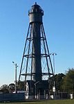
The Tinicum Island Rear Range Light is a lighthouse located in the Billingsport section of Paulsboro, Gloucester County, New Jersey, United States, the rear of a pair of range lights marking a section of the channel in the Delaware River south of Philadelphia, Pennsylvania. The lighthouse, surrounded by ball fields next to the new marine terminal for the Port of Paulsboro, is still active for navigation on the Delaware River. It works in conjunction with the Tinicum Front Range Light, known as the Billingsport Front Light, situated on the banks of the Delaware River at the front of Fort Billings Park next to the Paulsboro Refinery. Front and rear range lighthouses guide sailors who, by aligning the two lights and keeping one light on top of the other, stay in its center and avoid Little Tinicum Island as they travel upstream.The Tinicum Island Range Lights were activated on New Year's Eve 1880. They had a visible range of 8.5 nautical miles (15.7 km; 9.8 mi). The lights were changed from oil to electric in 1917. The Coast Guard automated the lights in 1933. The light tower originally had a keeper's dwelling with seven rooms, along with a brick oil house, frame barn and barnyard, cow shed, poultry house, and privy on 4.8 acres (1.9 ha) of land. The dwelling buildings were demolished sometime in the 1950s after they fell into disrepair. The rear range lighthouse, which is owned by the United States Coast Guard, was added to the National Register of Historic Places on September 15, 2005.Tinicum Rear Range Lighthouse Society offers regular tours, including a climb to the top of the tower, the third full weekend of each month from April through October and special tours with advance notice. Surrounding views from the lighthouse include Philadelphia and its airport.

Philadelphia International Airport

Philadelphia International Airport (IATA: PHL, ICAO: KPHL, FAA LID: PHL) is the primary airport serving Philadelphia, Pennsylvania. The airport serves 31.7 million passengers annually, making it the 21st busiest airport in the United States. In 2019, PHL served 33,018,886 passengers, the most in the airport's history. The airport is located 7 miles (11 km) from the city's downtown area and has 22 airlines that offer nearly 500 daily departures to more than 130 destinations worldwide.Philadelphia International Airport is the largest airport serving the state of Pennsylvania. It is the fifth-largest hub for American Airlines and its primary hub for the Northeastern United States, as well as its primary European and transatlantic gateway. Additionally, the airport is a regional cargo hub for UPS Airlines and a focus city for the ultra low-cost airline Frontier Airlines. The airport has service to cities in the United States, Canada, the Caribbean, Latin America, Europe, and the Middle East. As of summer 2019, there are flights from the airport to 140 destinations, 102 domestic and 38 international. Most of the airport property is in Philadelphia proper. The international terminal and the western end of the airfield are in Tinicum Township, Delaware County. PHL covers 2,302 acres (932 ha) and has four runways.Philadelphia International Airport is important to Philadelphia, its metropolitan region and the Commonwealth of Pennsylvania. The Commonwealth's Aviation Bureau reported in its Pennsylvania Air Service Monitor that the total economic impact made by the state's airports in 2004 was $22 billion. In 2017, PHL commissioned a new economic impact report. The report found PHL alone accounted for $15.4 billion in activity with over 96,000 direct and indirect jobs with $5.4 billion in total earnings.