place

2012 Paulsboro train derailment

2012 disasters in the United States2012 in New Jersey2012 industrial disastersAccidents and incidents involving ConrailAccidents and incidents involving Norfolk Southern Railway
Chemical disastersDerailments in the United StatesEnvironmental disasters in the United StatesPaulsboro, New JerseyRailway accidents and incidents in New JerseyRailway accidents in 2012
Paulsboro aerialIMG 0441 (12816143035)

On November 30, 2012, a daily freight train running on Conrail Shared Assets Operations Penns Grove Secondary derailed in Paulsboro, a borough with an industrial and maritime economy, in Gloucester County, New Jersey. As a result, vinyl chloride from one car leaked into the air. In 2023 several news reports drew parallels between this derailment and the 2023 Ohio train derailment in East Palestine, Ohio, which also involved release of vinyl chloride.

Excerpt from the Wikipedia article 2012 Paulsboro train derailment (License: CC BY-SA 3.0, Authors, Images).

2012 Paulsboro train derailment
Mantua Avenue,

Geographical coordinates (GPS) Address Nearby Places
placeShow on map

Wikipedia: 2012 Paulsboro train derailmentContinue reading on Wikipedia

Geographical coordinates (GPS)

Latitude Longitude
N 39.834609 ° E -75.236786 °
placeShow on map

Address

Mantua Avenue
08066
New Jersey, United States
mapOpen on Google Maps

Paulsboro aerialIMG 0441 (12816143035)
Share experience

Nearby Places

Tinicum Island Rear Range Light

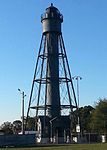
The Tinicum Island Rear Range Light is a lighthouse located in the Billingsport section of Paulsboro, Gloucester County, New Jersey, United States, the rear of a pair of range lights marking a section of the channel in the Delaware River south of Philadelphia, Pennsylvania. The lighthouse, surrounded by ball fields next to the new marine terminal for the Port of Paulsboro, is still active for navigation on the Delaware River. It works in conjunction with the Tinicum Front Range Light, known as the Billingsport Front Light, situated on the banks of the Delaware River at the front of Fort Billings Park next to the Paulsboro Refinery. Front and rear range lighthouses guide sailors who, by aligning the two lights and keeping one light on top of the other, stay in its center and avoid Little Tinicum Island as they travel upstream.The Tinicum Island Range Lights were activated on New Year's Eve 1880. They had a visible range of 8.5 nautical miles (15.7 km; 9.8 mi). The lights were changed from oil to electric in 1917. The Coast Guard automated the lights in 1933. The light tower originally had a keeper's dwelling with seven rooms, along with a brick oil house, frame barn and barnyard, cow shed, poultry house, and privy on 4.8 acres (1.9 ha) of land. The dwelling buildings were demolished sometime in the 1950s after they fell into disrepair. The rear range lighthouse, which is owned by the United States Coast Guard, was added to the National Register of Historic Places on September 15, 2005.Tinicum Rear Range Lighthouse Society offers regular tours, including a climb to the top of the tower, the third full weekend of each month from April through October and special tours with advance notice. Surrounding views from the lighthouse include Philadelphia and its airport.

C. A. Nothnagle Log House

C. A. Nothnagle Log House (also known as Braman-Nothnagle Log House) is a historic house on Swedesboro-Paulsboro Road near Swedesboro in the Gibbstown section of Greenwich Township, Gloucester County, New Jersey, United States. It is one of the oldest surviving log houses in the United States.The oldest part of the house was built sometime between 1638 and 1643 by Finnish or Swedish settlers in the New Sweden colony, and Nordic ironware from the 1590s is still extant around the fireplace. The fireplace, probably built of bricks brought over to North America as ship's ballast, is asymmetric and placed in a corner of the cabin. The original cabin measures 16 by 22 feet, which indicates that the builders were relatively well off; an average sized dwelling of the period was 12 by 12 feet. It is built of oak logs, and two logs were removable to provide ventilation in the summer. The logs were double dovetailed to provide a close fit, and gravel was pounded between the chinks in the logs. No nails were used in the original construction; hardwood pegs were used as fasteners. There is no ridgepole in the roof. People lived in this part of the house until 1918.A large addition to the original cabin was constructed in the early 18th century. A wooden floor was built over the original dirt floor around 1730. The house was added to the National Register of Historic Places in 1976 and is still privately owned. The cabin is opened for tours by appointment through the current owner, Doris Rink, who resides in the adjoining structure.