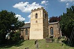
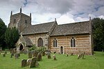
Worton (civil parish), Oxfordshire
Civil parishes in OxfordshireOxfordshire geography stubsWest Oxfordshire District
Worton is a civil parish in the West Oxfordshire district about 7 miles (11 km) south of Banbury, England. It was formed in 1932 by the merger of the parishes of Nether Worton and Over Worton, each of which is a small village. The main road between Deddington and Swerford is the parish's northern boundary. It was a turnpike road and is now the B4031. From there the parish extends 4 miles (6.4 km) to Worton Wood on its southern boundary. East–west the parish is nowhere more than 1+3⁄4 miles (3 km) wide. The 2011 Census recorded the population of Worton parish as 624.
Excerpt from the Wikipedia article Worton (civil parish), Oxfordshire (License: CC BY-SA 3.0, Authors).Worton (civil parish), Oxfordshire
West Oxfordshire Worton
Geographical coordinates (GPS) Address Nearby Places Show on map
Geographical coordinates (GPS)
| Latitude | Longitude |
|---|---|
| N 51.959 ° | E -1.378 ° |
Address
OX7 7EP West Oxfordshire, Worton
England, United Kingdom
Open on Google Maps


