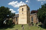
Hempton, Oxfordshire
Cherwell DistrictOxfordshire geography stubsUse British English from August 2015Villages in Oxfordshire

Hempton is a village in Deddington civil parish about 5 miles (8 km) south of Banbury in Oxfordshire. Hempton is on the B4031 road between Deddington and Chipping Norton, which was a turnpike from 1770 until 1871.
Excerpt from the Wikipedia article Hempton, Oxfordshire (License: CC BY-SA 3.0, Authors, Images).Hempton, Oxfordshire
Old Plough Walk, Cherwell District
Geographical coordinates (GPS) Address Nearby Places Show on map
Geographical coordinates (GPS)
| Latitude | Longitude |
|---|---|
| N 51.983 ° | E -1.355 ° |
Address
Old Plough Walk
Old Plough Walk
OX15 0RA Cherwell District
England, United Kingdom
Open on Google Maps


