Barford St John
Cherwell DistrictFormer civil parishes in OxfordshireOpenDomesdayUse British English from August 2015Villages in Oxfordshire

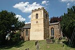
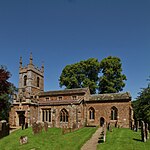
Barford St. John is a small village and former civil parish, now in the parish of Barford St. John and St. Michael, in the Cherwell district, in the county of Oxfordshire, England. It is on the north bank of the River Swere, about 5 miles (8 km) south of Banbury. In the Middle Ages it was sometimes called Little Barford or North Barford to distinguish it from the larger village of Barford St. Michael on the opposite bank of the Swere. In 1931 the parish had a population of 53.
Excerpt from the Wikipedia article Barford St John (License: CC BY-SA 3.0, Authors, Images).Barford St John
Bloxham Road, Cherwell District Barford St. John and St. Michael
Geographical coordinates (GPS) Address Nearby Places Show on map
Geographical coordinates (GPS)
| Latitude | Longitude |
|---|---|
| N 51.996 ° | E -1.363 ° |
Address
Bloxham Road
Bloxham Road
OX15 0PP Cherwell District, Barford St. John and St. Michael
England, United Kingdom
Open on Google Maps


