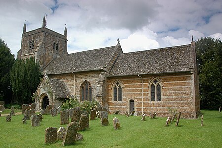
Duns Tew
Civil parishes in OxfordshireUse British English from August 2015Villages in Oxfordshire

Duns Tew is an English village and civil parish about 7+1⁄2 miles (12 km) south of Banbury in Oxfordshire. The 2011 Census recorded the parish's population as 478. With nearby Great Tew and Little Tew, Duns Tew is one of the three villages known collectively as "The Tews". A 'tew' is believed to be an ancient term for a ridge of land.
Excerpt from the Wikipedia article Duns Tew (License: CC BY-SA 3.0, Authors, Images).Duns Tew
Main Street, Cherwell District Duns Tew
Geographical coordinates (GPS) Address Nearby Places Show on map
Geographical coordinates (GPS)
| Latitude | Longitude |
|---|---|
| N 51.954 ° | E -1.336 ° |
Address
Main Street
OX25 6JL Cherwell District, Duns Tew
England, United Kingdom
Open on Google Maps


