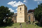
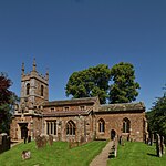
Barford St. John and St. Michael
Cherwell DistrictCivil parishes in OxfordshireOxfordshire geography stubs
Barford St John and St Michael is a civil parish in the Cherwell district of Oxfordshire, England. It includes the adjacent villages of Barford St. Michael and Barford St. John, which stand either side of the River Swere. At the 2011 census the parish had a population of 549 mainly clustered into the two nucleated villages surrounded by green fields and woodland. The total parish area is 7.48 km2 .
Excerpt from the Wikipedia article Barford St. John and St. Michael (License: CC BY-SA 3.0, Authors).Barford St. John and St. Michael
Bloxham Road, Cherwell District Barford St. John and St. Michael
Geographical coordinates (GPS) Address Nearby Places Show on map
Geographical coordinates (GPS)
| Latitude | Longitude |
|---|---|
| N 51.993 ° | E -1.364 ° |
Address
Bloxham Road
Bloxham Road
OX15 0PP Cherwell District, Barford St. John and St. Michael
England, United Kingdom
Open on Google Maps


