Bombing of the Bezuidenhout

The bombing of the Bezuidenhout (Dutch: bombardement op het Bezuidenhout) took place on 3 March 1945, when the Royal Air Force mistakenly bombed the Bezuidenhout neighbourhood in the Dutch city of The Hague. At the time, the neighbourhood was more densely populated than usual with evacuees from The Hague and Wassenaar; tens of thousands were left homeless and had to be quartered in the Eastern and Central Netherlands. The British bomber crews had intended to bomb the Haagse Bos ("Forest of the Hague") district where the Germans had installed V-2 launching facilities that had been used to attack English cities. However, the pilots were issued with the wrong coordinates so the navigational instruments of the bombers had been set incorrectly, and combined with fog and clouds which obscured their vision, the bombs were instead dropped on the Bezuidenhout residential neighbourhood.
Excerpt from the Wikipedia article Bombing of the Bezuidenhout (License: CC BY-SA 3.0, Authors, Images).Bombing of the Bezuidenhout
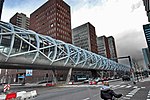
De Carpentierstraat, The Hague Haagse Hout
Geographical coordinates (GPS) Address Nearby Places Show on map
Geographical coordinates (GPS)
| Latitude | Longitude |
|---|---|
| N 52.084 ° | E 4.338 ° |
Address
De Carpentierstraat 137E
2595 HH The Hague, Haagse Hout
South Holland, Netherlands
Open on Google Maps


