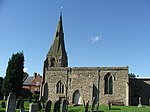
East Midlands Airport

East Midlands Airport (IATA: EMA, ICAO: EGNX) is an international airport in the East Midlands of England, close to Castle Donington in northwestern Leicestershire, between Loughborough (10 miles (16 km)), Derby (12.5 miles (20 km)) and Nottingham (14 miles (23 km)); Leicester is (20 miles (32 km)) to the south and Lincoln (43 miles (69 km)) northeast. It serves the majority of the East Midlands region consisting of Leicestershire, Nottinghamshire, Southern Lincolnshire, Rutland and Derbyshire. The airfield was originally built as a Royal Air Force station known as RAF Castle Donington in 1943, before being redeveloped as a civilian airport in 1965. East Midlands Airport has established itself as a hub for low-fare airlines such as Jet2.com and Ryanair and tour operators like TUI Airways, which serve a range of domestic and European short-haul destinations. Passenger numbers peaked in 2008 at 5.6 million but declined to around 4.5 million in 2015, making it the 11th-busiest airport in the UK by passenger traffic. A central air cargo hub, it was the second-busiest UK airport for freight traffic in 2016, after London Heathrow.The airport is owned by the Manchester Airports Group (MAG), the largest British-owned airport operator, which is controlled by the ten metropolitan borough councils of Greater Manchester, with Manchester City Council retaining the controlling stake.
Excerpt from the Wikipedia article East Midlands Airport (License: CC BY-SA 3.0, Authors, Images).East Midlands Airport
Hill Top, North West Leicestershire
Geographical coordinates (GPS) Address Website External links Nearby Places Show on map
Geographical coordinates (GPS)
| Latitude | Longitude |
|---|---|
| N 52.833333333333 ° | E -1.3333333333333 ° |
Address
East Midlands Airport
Hill Top
DE74 2PR North West Leicestershire
England, United Kingdom
Open on Google Maps


