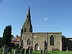
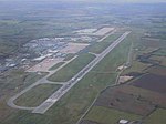
Castle Donington Rural District
The rural district of Castle Donington in Leicestershire, England, was formed in 1894 and abolished in 1974. It was formed by the Local Government Act 1894 from the part of the Shadlow Rural Sanitary District that was in Leicestershire. It gained a few parishes from the disbanding of Loughborough Rural District in the 1930s. It included the following parishes at its abolition Belton (from Loughborough RD) Breedon on the Hill Castle Donington Charley (from Loughborough RD) Diseworth Hemington Isley cum Langley Kegworth Lockington Hemington Long Whatton (from Loughborough RD)The district was merged into the North West Leicestershire district under the Local Government Act 1972.
Excerpt from the Wikipedia article Castle Donington Rural District (License: CC BY-SA 3.0, Authors).Castle Donington Rural District
Hyam's Lane, North West Leicestershire Long Whatton and Diseworth
Geographical coordinates (GPS) Address Nearby Places Show on map
Geographical coordinates (GPS)
| Latitude | Longitude |
|---|---|
| N 52.82 ° | E -1.32 ° |
Address
Hyam's Lane
Hyam's Lane
DE74 2TL North West Leicestershire, Long Whatton and Diseworth
England, United Kingdom
Open on Google Maps


