Ma Tau Chung
Kowloon City DistrictMa Tau ChungPopulated places in Hong KongRivers of Hong Kong

Ma Tau Chung (Chinese: 馬頭涌 or 碼頭涌) is an area in Kowloon, Hong Kong, west of Ma Tau Kok and east of Ma Tau Wai. It was named after a creek (hence 涌, Chung, in the name) which originated in Quarry Hill emptying into Kowloon Bay. The village of Ma Tau Chung stood on its banks near the river mouth near the Sacred Hill. Ma Tau Chung Road is named after the historical place name. It is the major surface road for traffic between Kowloon City and other areas to the east, onwards through Prince Edward Road West and Prince Edward Road East, and areas in southern Kowloon, through Ma Tau Wai Road.
Excerpt from the Wikipedia article Ma Tau Chung (License: CC BY-SA 3.0, Authors, Images).Ma Tau Chung
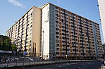
Ma Tau Chung Road, Kowloon Ma Tau Chung (Kowloon City District)
Geographical coordinates (GPS) Address Nearby Places Show on map
 Continue reading on Wikipedia
 Geographical coordinates (GPS)
| Latitude | Longitude |
|---|---|
| N 22.3248 ° | E 114.1893 ° |
Address
宋王臺花園 Sung Wong Toi Garden
Ma Tau Chung Road
Kowloon, Ma Tau Chung (Kowloon City District)
Hong Kong, China
Open on Google Maps