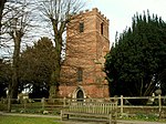
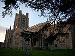
Quendon and Rickling
Civil parishes in EssexUttlesford

Quendon and Rickling is a civil parish in the Uttlesford district of Essex, England with an area of 2,048 acres. The population of the civil parish at the 2011 was 587. It is a linear settlement on the B1383 (formerly the A11 trunk road) between Saffron Walden and Bishops Stortford. Quendon & Rickling stand 300 feet above sea level on a watershed between two rivers: the Cam to the east, flowing north through Cambridge to the Ouse flowing on to the Wash.
Excerpt from the Wikipedia article Quendon and Rickling (License: CC BY-SA 3.0, Authors, Images).Quendon and Rickling
Rickling Green Road, Uttlesford Quendon and Rickling
Geographical coordinates (GPS) Address Nearby Places Show on map
Geographical coordinates (GPS)
| Latitude | Longitude |
|---|---|
| N 51.95 ° | E 0.199 ° |
Address
Rickling Green Road
Rickling Green Road
CB11 3XE Uttlesford, Quendon and Rickling
England, United Kingdom
Open on Google Maps


