Ugley

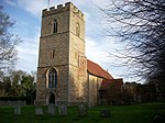
Ugley is a small village and civil parish in the non-metropolitan district of Uttlesford in Essex, England. It is about 2 miles (3 km) north from Stansted Mountfitchet, and situated between Saffron Walden and Bishop's Stortford. Within the parish is the village of Ugley Green, 1.5 miles (2.4 km) to the south. Ugley was first recorded in 1041 as "Uggele". It appears in the Domesday Book as "Ugghelea", in the ancient hundred of Claverling. The name probably means "woodland clearing of a man named Ugga."Within Ugley there are several buildings of the 16th and 17th centuries. The Grade II* listed church, St Peter's, has a 13th-century nave and a Tudor brick tower. Orford House is a Grade II* listed building built by Edward Russell, 1st Earl of Orford, c.1700.The village's name has been noted on lists of unusual place names.
Excerpt from the Wikipedia article Ugley (License: CC BY-SA 3.0, Authors, Images).Ugley
Vicarage Lane, Uttlesford Ugley
Geographical coordinates (GPS) Address Nearby Places Show on map
Geographical coordinates (GPS)
| Latitude | Longitude |
|---|---|
| N 51.9342 ° | E 0.2103 ° |
Address
Vicarage Lane
CM22 6HU Uttlesford, Ugley
England, United Kingdom
Open on Google Maps


