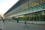
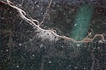
Geography of Rosario
Geography of Santa Fe ProvinceRosario, Santa FeUse Canadian English from February 2019

This article is about the geography and urban structure of Rosario, which is the largest city of the province of Santa Fe, Argentina, and the third most populous in the country, after Córdoba and Buenos Aires. It is located about 300 km (190 mi) north of Buenos Aires, on the Western shore of the Paraná River, and it has about 910,000 inhabitants. It is surrounded by smaller cities and towns that form a metropolitan area (Greater Rosario) with a population of about 1.2 million according to the 2001 census [INDEC].
Excerpt from the Wikipedia article Geography of Rosario (License: CC BY-SA 3.0, Authors, Images).Geography of Rosario
Magallanes, Rosario Villa Urquiza (Distrito Oeste)
Geographical coordinates (GPS) Address Nearby Places Show on map
Geographical coordinates (GPS)
| Latitude | Longitude |
|---|---|
| N -32.950555555556 ° | E -60.704166666667 ° |
Address
Magallanes 1894
S2009 Rosario, Villa Urquiza (Distrito Oeste)
Santa Fe, Argentina
Open on Google Maps


