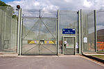
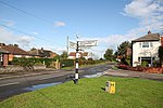
RAF Swinderby
1940 establishments in the United Kingdom1994 disestablishments in the United KingdomEducation in LincolnshireMilitary installations closed in 1994North Kesteven District ... and 4 more
Royal Air Force stations in LincolnshireRoyal Air Force stations of World War II in the United KingdomTraining establishments of the Royal Air ForceUse British English from January 2015

Royal Air Force Swinderby or more simply RAF Swinderby is a former Royal Air Force station airfield opened in 1940, one of the last of the stations completed under the RAF's expansion plans started in the 1930s. It was built near the village of Swinderby, Lincolnshire just off the south east side of the A46 (the Fosse Way) between Newark-on-Trent, Nottinghamshire and Lincoln, Lincolnshire, England. The station closed on 17 December 1993.
Excerpt from the Wikipedia article RAF Swinderby (License: CC BY-SA 3.0, Authors, Images).RAF Swinderby
North Kesteven Witham St. Hughs
Geographical coordinates (GPS) Address Nearby Places Show on map
Geographical coordinates (GPS)
| Latitude | Longitude |
|---|---|
| N 53.146944444444 ° | E -0.67111111111111 ° |
Address
LN6 9BJ North Kesteven, Witham St. Hughs
England, United Kingdom
Open on Google Maps


