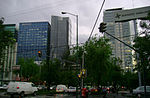
place

Tacubaya

Former municipalities of the Mexican Federal DistrictMiguel Hidalgo, Mexico CityNeighborhoods in Mexico CityStates and territories disestablished in 1928States and territories established in the 16th century

Tacubaya is a working-class area of west-central Mexico City, in the borough of Miguel Hidalgo, consisting of the colonia Tacubaya proper and adjacent areas in other colonias, with San Miguel Chapultepec sección II, Observatorio, Daniel Garza and Ampliación Daniel Garza being also considered part of Tacubaya.The area has been inhabited since the fifth century BCE. Its name comes from Nahuatl, meaning “where water is gathered.” From the colonial period to the beginning of the 20th century, Tacubaya was an separate entity to Mexico City and many of the city’s wealthy, including viceroys, built residences here to enjoy the area’s scenery. From the mid-19th century on, Tacubaya began to urbanize both due to the growth of Mexico City and the growth of its own population. Along with this urbanization, the area has degraded into one of the poorer sections of the city and contains the “La Ciudad Perdida” (The Lost City), a shantytown where people live in shacks of cardboard and other materials. Many of the mansions that were built here in the 19th century remain, such as the Casa Amarilla and Casa de la Bola, but most Mexico City residents are familiar with it due to its transportation hub on Avenida Jalisco where the Metro, Metrobus and many street buses all converge.This area was designated as a "Barrio Mágico" by the city in 2011.

Excerpt from the Wikipedia article Tacubaya (License: CC BY-SA 3.0, Authors).

Tacubaya
Calle 2ª Cerrada José María Vigil, Mexico City

Geographical coordinates (GPS) Address Nearby Places
placeShow on map

Wikipedia: TacubayaContinue reading on Wikipedia

Geographical coordinates (GPS)

Latitude Longitude
N 19.40095 ° E -99.187230555556 °
placeShow on map

Address

Calle 2ª Cerrada José María Vigil

Calle 2ª Cerrada José María Vigil
11870 Mexico City
Mexico
mapOpen on Google Maps

Share experience

Nearby Places

Escandón

Escandón is one of the colonias of Mexico City that were founded at the beginning of the 19th century on crop terrains that were formerly part of the haciendas. This colony formed part of the Hacienda de la Condesa, being property of the family Escandón, who fractionated the terrains situated south of this. The colony is divided in two: Escandón I and Escandón II, because of its big extension. The first section is located from the Patriotismo Avenue and confines with the Tacubaya neighborhood; whereas the second section extends from the Viaducto Miguel Alemán and confines with the Condesa Neighborhood. Escandón II has greater economic and social success than its homologous. The colony still preserves some of the constructions that were built in the first half of the 20th century, particularly from architectural styles as: art decó, colonial Californian, and the neocolonial. At the north, given the vicinity to the Tacubaya neighborhood, some examples of constructions that correspond to the architecture ecléctica can be appreciated. The greater part of the buildings constructed around the middle of the 20th century correspond to apartment buildings. As many other colonies founded in the first half of the 20th century, Escandón has several services and businesses that aim to attend the local population; some examples of this are the Jardín Morelos park and the market established in front of it. In recent times, the neighborhood has experimented a development in real-estate activities because it is near neighborhoods of medium-high economic levels, like Condesa, Roma, Nápoles and del Valle.