San Miguel Chapultepec

San Miguel Chapultepec is a colonia or neighborhood in Delegación Miguel Hidalgo in Mexico City. Its borders are: Avenida Constituyentes and Avenida Chapultepec on the west, bordering Chapultepec Park The Circuito Interior José Vasconcelos and Ave. Jalisco on the southeast, bordering the Condesa district (colonias Condesa and Hipódromo Condesa) and colonia Tacubaya Parque Lira on the southwest, bordering colonias Ampliación Daniel Garza, Observatorio and TacubayaThe colonia's streets carry the names of generals and governors of Mexico. The buildings mostly consist of houses, whether still used as residences or converted into offices. Being a central neighborhood where the Circuito Interior freeway, Ave. Constituyentes (a main through road to Santa Fe, Toluca and points west), and the Ejes viales 2 and 4 South, the area is saturated with traffic.
Excerpt from the Wikipedia article San Miguel Chapultepec (License: CC BY-SA 3.0, Authors, Images).San Miguel Chapultepec
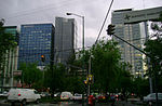
Calle Gobernador Ignacio Esteva, Mexico City
Geographical coordinates (GPS) Address Nearby Places Show on map
 Continue reading on Wikipedia
 Geographical coordinates (GPS)
| Latitude | Longitude |
|---|---|
| N 19.411473 ° | E -99.188521 ° |
Address
Cafevera
Calle Gobernador Ignacio Esteva 39
11850 Mexico City
Mexico
Open on Google Maps