place

Parque Lira

Miguel Hidalgo, Mexico CityParks in Mexico City
Parque Lira Arco de Entrada (Francesco Saverio Cavallari)

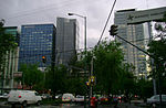
Parque Lira is a public park in the Tacubaya district of Mexico City, once a separate town from Mexico City. It is located on the 18th century estate of Vicente Lira. It is entered by a monumental archway designed by Italian architect Francesco Saverio Cavallari, an Italian architect who was active in Mexico 1857–1864.The land was part of what was once a vast estate, including the Casa de la Bola (now a cultural center), that once belonged to Mariana Gomez de la Cortina, the second Countess of Cortina. After her death on January 6, 1846, the land was subdivided, and part became property of the Lira Mora family, textile moguls, during the first part of the twentieth century. The gardens were adorned with a palace, bridges, water mirrors, a pergola and bronze fountains as well as a neoclassical grand archway at the entrance. During the Lázaro Cárdenas del Río government the land was expropriated and an asylum was established here for children with mental illnesses; which functioned until the offices of the Miguel Hidalgo borough were established adjacent to what is now the park.The park is located on the eponymous avenue and nearby is an eponymous Metrobús (BRT) stop.

Excerpt from the Wikipedia article Parque Lira (License: CC BY-SA 3.0, Authors, Images).

Parque Lira
Avenida Parque Lira, Mexico City

Geographical coordinates (GPS) Address Nearby Places
placeShow on map

Wikipedia: Parque LiraContinue reading on Wikipedia

Geographical coordinates (GPS)

Latitude Longitude
N 19.4053073 ° E -99.1882693 °
placeShow on map

Address

Museo Casa de la Bola

Avenida Parque Lira
11850 Mexico City
Mexico
mapOpen on Google Maps

Parque Lira Arco de Entrada (Francesco Saverio Cavallari)
Share experience

Nearby Places

Escandón

Escandón is one of the colonias of Mexico City that were founded at the beginning of the 19th century on crop terrains that were formerly part of the haciendas. This colony formed part of the Hacienda de la Condesa, being property of the family Escandón, who fractionated the terrains situated south of this. The colony is divided in two: Escandón I and Escandón II, because of its big extension. The first section is located from the Patriotismo Avenue and confines with the Tacubaya neighborhood; whereas the second section extends from the Viaducto Miguel Alemán and confines with the Condesa Neighborhood. Escandón II has greater economic and social success than its homologous. The colony still preserves some of the constructions that were built in the first half of the 20th century, particularly from architectural styles as: art decó, colonial Californian, and the neocolonial. At the north, given the vicinity to the Tacubaya neighborhood, some examples of constructions that correspond to the architecture ecléctica can be appreciated. The greater part of the buildings constructed around the middle of the 20th century correspond to apartment buildings. As many other colonies founded in the first half of the 20th century, Escandón has several services and businesses that aim to attend the local population; some examples of this are the Jardín Morelos park and the market established in front of it. In recent times, the neighborhood has experimented a development in real-estate activities because it is near neighborhoods of medium-high economic levels, like Condesa, Roma, Nápoles and del Valle.