place

Marine Park (Brooklyn park)

Education in BrooklynMarine Park, BrooklynNature centers in New York CityParks in BrooklynSkateparks in New York City
Use mdy dates from August 2019
MarineParkWinter
MarineParkWinter

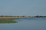
Marine Park is a public park located in the neighborhood of Marine Park in Brooklyn, New York. Its 798 acres (3.2 km2) surround the westernmost inlet of Jamaica Bay. Most of the land for Marine Park was donated to New York City to be turned into public park land by the Whitney family in 1920 and by Frederic B. Pratt and Alfred Tredway White, who jointly donated 150 acres (0.61 km2) in 1917. The land donated consists of the area between the current day Fillmore Avenue and Gerritsen Avenue and East 38th Street. Originally almost 2,000 acres (810 ha), over half of which has been donated to the National Park Service as part of the Gateway National Recreation Area, the park is mainly a fertile salt marsh which is supplied with freshwater from Gerritsen Creek. Marine Park consists of recreational park areas and the Salt Marsh Nature Center, where marsh birds, cottontail rabbits, horseshoe crabs, and oyster toadfish can be found.

Excerpt from the Wikipedia article Marine Park (Brooklyn park) (License: CC BY-SA 3.0, Authors, Images).

Marine Park (Brooklyn park)
Marine Park Salt Marsh Nature Trail, New York Brooklyn

Geographical coordinates (GPS) Address Nearby Places
placeShow on map

Wikipedia: Marine Park (Brooklyn park)Continue reading on Wikipedia

Geographical coordinates (GPS)

Latitude Longitude
N 40.598047 ° E -73.920836 °
placeShow on map

Address

Marine Park Salt Marsh Nature Trail

Marine Park Salt Marsh Nature Trail
11234 New York, Brooklyn
New York, United States
mapOpen on Google Maps

MarineParkWinter
MarineParkWinter
Share experience

Nearby Places

Mill Basin, Brooklyn

Mill Basin is a residential neighborhood in southeastern Brooklyn, New York City. It is on a peninsula abutting Jamaica Bay and is bordered by Avenue U on the northwest and the Mill Basin/Mill Island Inlet on its remaining sides. Mill Basin is adjacent to the neighborhood of Bergen Beach to the northeast, Flatlands to the northwest, Marine Park to the southwest, and Floyd Bennett Field and the former Barren Island to the southeast. Mill Basin also contains a subsection called Old Mill Basin, north of Avenue U. Mill Basin was originally Mill Island, Jamaica Bay. In the 17th century, a mill was built on Mill, Bergen, and Barren Islands. The archipelago was then occupied by the Schenck and Crooke families through the late 19th century, and remained a mostly rural area with oyster fishing. After Robert Crooke developed a smelting plant on Mill Island in 1890, industrial customers started developing the island and connected it to the rest of Brooklyn. In an effort to develop Mill Basin as a seaport district, ports and dry docks were built in the early 20th century, though a lack of railroad connections hindered the area's further growth. Residential development began in the 1950s, along with the rest of southeast Brooklyn, though some of the former industrial buildings remain. Mill Basin has some of the most luxurious houses in New York City, though it also contains commercial and industrial tenants, as well as the Kings Plaza shopping mall in its western part. The area around Mill Basin consists of a mostly white population as of the 2010 United States Census, and is sparsely served by public transportation. Nearby recreational areas include Floyd Bennett Field, the first municipal airport in New York City, which is part of the Gateway National Recreation Area and is just southeast of Mill Basin. Mill Basin is part of Brooklyn Community District 18, and its primary ZIP Code is 11234. It is patrolled by the 63rd Precinct of the New York City Police Department.