Marine Park (neighborhood), Brooklyn
Marine Park, BrooklynNeighborhoods in Brooklyn

Marine Park is a neighborhood in the New York City borough of Brooklyn. The neighborhood lies between Flatlands and Mill Basin to the east, and Gerritsen Beach, Midwood, and Sheepshead Bay to the south and west. It is mostly squared off in area by Gerritsen Avenue, Flatbush Avenue, Avenue U and Kings Highway. The neighborhood's eponymous park is the largest public park in Brooklyn. Charles Downing Lay won a silver medal in town planning at the 1936 Olympics for the planning of Marine Park.Marine Park is largely inhabited by ethnic groups such as Italians, Irish, Greeks, and Jews. The area is part of Brooklyn Community Board 18.
Excerpt from the Wikipedia article Marine Park (neighborhood), Brooklyn (License: CC BY-SA 3.0, Authors, Images).Marine Park (neighborhood), Brooklyn
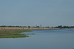
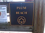
Marine Park Salt Marsh Nature Trail, New York Brooklyn
Geographical coordinates (GPS) Address Nearby Places Show on map
Geographical coordinates (GPS)
| Latitude | Longitude |
|---|---|
| N 40.598 ° | E -73.92 ° |
Address
Marine Park Salt Marsh Nature Trail
Marine Park Salt Marsh Nature Trail
11234 New York, Brooklyn
New York, United States
Open on Google Maps


