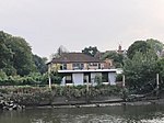
River Crane, London

The River Crane, a tributary of the River Thames, runs 8.5 miles (13.6 km) in West London, England. It forms the lower course of Yeading Brook. It adjoins or passes through three London boroughs: Hillingdon, Hounslow and Richmond upon Thames, in the historic county of Middlesex. The drainage basin is heavily urbanised but many of the Hayes to Whitton flood-meadows have been conserved, forming a narrow, green vale, opening out to what remains of Hounslow Heath in the centre – a near-continuous belt of semi-natural habitat. At the start of the twentieth century several small sewage works discharged to the river. However these have been consolidated with others into one (Mogden Sewage Treatment Works) which discharges directly to the upper estuary of the Thames (the Tideway). The Crane's form has been greatly altered by river engineering works: over centuries the watercourse has been subject to widening, narrowing, straightening, dredging and bank reinforcement. The greatest of such works has been the two-phase construction of the Duke of Northumberland's River (DNR), a tributary and distributary, to guarantee water power to mills, now demolished, across the south and southeast of Isleworth, which in latter decades worked calico cloth as well as grain. The Lower DNR also waters the grand fish pond inherited from Syon Abbey, which gave way in the dissolution of the monasteries to Syon House and Syon Park. The semi-private park, with its scenic tea room, garden centre and hotel, has a nature reserve zone alongside the Thames. Its lake is still refreshed via sluice and culvert from the Lower DNR's Mill Plat, and thus is supplied by virtue of the Crane from the Colne and the Yeading Brook. The latter means the river system has sources in the London Boroughs of Harrow and Ealing [in Southall as an overflow offtake from the Paddington Arm of the Grand Union Canal].
Excerpt from the Wikipedia article River Crane, London (License: CC BY-SA 3.0, Authors, Images).River Crane, London
Railshead Road, London St Margarets (London Borough of Richmond upon Thames)
Geographical coordinates (GPS) Address Nearby Places Show on map
Geographical coordinates (GPS)
| Latitude | Longitude |
|---|---|
| N 51.465277777778 ° | E -0.32222222222222 ° |
Address
Railshead Road
TW1 1RJ London, St Margarets (London Borough of Richmond upon Thames)
England, United Kingdom
Open on Google Maps


