place

Richmond Lock and Footbridge

1894 establishments in EnglandBridges completed in 1894Former toll bridges in EnglandGrade II* listed bridges in EnglandGrade II* listed buildings in the London Borough of Richmond upon Thames
Locks of LondonLocks on the River ThamesPedestrian bridges across the River ThamesPedestrian bridges in LondonRichmond, LondonTidal barragesTourist attractions in the London Borough of Richmond upon ThamesTransport in the London Borough of Richmond upon ThamesUse British English from September 2017
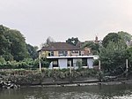
Richmond Lock from Isleworth,Middx looking SE

Richmond Lock and Footbridge is a lock, rising and falling low-tide barrage integrating controlled sluices and pair of pedestrian bridges on the River Thames in south west London, England and is a Grade II* listed structure. It is the furthest downstream of the forty-five Thames locks and the only one owned and operated by the Port of London Authority. It was opened in 1894 and is north-west of the centre of Richmond in a semi-urban part of south-west London. Downstream are Syon Park and Kew Gardens on opposite banks. It connects the promenade at Richmond with the neighbouring district of St. Margarets on the west bank during the day and is closed at night to pedestrians – after 19:30 GMT or after 21:30 when BST is in use. At high tide the sluice gates are raised and partly hidden behind metal arches forming twin footbridges. It was built to maintain the lowest-lying head of water of the forty-five navigable reaches of the Thames above the rest of the Tideway. Below the structure for a few miles, at low tide, the navigable channel is narrow and restricts access for vessels with the greatest draft. The next major point of mooring below the lock is, accordingly, at Brentford Dock.

Excerpt from the Wikipedia article Richmond Lock and Footbridge (License: CC BY-SA 3.0, Authors, Images).

Richmond Lock and Footbridge
Richmond Lock Footbridge, London St Margarets (London Borough of Richmond upon Thames)

Geographical coordinates (GPS) Address External links Nearby Places
placeShow on map

Wikipedia: Richmond Lock and FootbridgeContinue reading on Wikipedia

Geographical coordinates (GPS)

Latitude Longitude
N 51.462222222222 ° E -0.31722222222222 °
placeShow on map

Address

Richmond Lock Footbridge

Richmond Lock Footbridge
TW9 2QJ London, St Margarets (London Borough of Richmond upon Thames)
England, United Kingdom
mapOpen on Google Maps

linkWikiData (Q541166)
linkOpenStreetMap (24966558)

Richmond Lock from Isleworth,Middx looking SE
Share experience

Nearby Places

Twickenham Bridge
Twickenham Bridge

Twickenham Bridge crosses the River Thames in southwest London, England. Built in 1933 as part of the newly constructed "Chertsey Arterial Road", the bridge connects the Old Deer Park district of Richmond (historically Surrey) on the south bank of the river to St. Margarets (historically Middlesex) on the north bank, both within the London Borough of Richmond upon Thames. Twickenham Bridge gets its name from the fact that it is on the road to the town of Twickenham (also in the same London borough), which is approximately 3 km upstream from Twickenham Bridge, past Richmond Bridge. Given the bridge's unique position on the river, St Margarets is actually at the southwestern end of the bridge, despite being on the north bank, while Richmond, south of the Thames, is at the northeastern end of the bridge. The bridge forms part of today's A316 (Chertsey Road), which links Central and West London with the M3 motorway at Sunbury-on-Thames. The bridge's architect was Maxwell Ayrton and the head engineer was Alfred Dryland. The proposed design of the bridge envisaged four 70 foot towers to be constructed on the riverbanks with retaining walls of 20 feet above road level. The plans were widely opposed and a local petition was organised by The Daily Telegraph against the design on the grounds that it was inappropriate to the setting in Richmond. The final design of the bridge was of three reinforced-concrete arches supported on concrete piers with Art Deco embellishments. The bridge incorporates three permanent hinges enabling the structure to adjust to changes in temperature, the first reinforced concrete bridge structure in the UK to use such an innovation. The arch springings, as well as the arch crowns, have decorative bronze cover plates. Ribbed shuttering was used in the casting of the concrete piers and abutments, giving the main faces a ribbed finish that was then knocked back. The approach viaduct and retaining walls were constructed in precast blocks that were wire brushed to create a rough finish. The balustrades and lamps were constructed of open bronzework. The Bromsgrove Guild was employed in casting and fitting the bronze lamp standards and parapets as well as the railings on the four staircases between road level and the river bank The bridge was opened on 3 July 1933 by Edward, Prince of Wales. In 1992, the first Gatso speed camera in the United Kingdom was launched on Twickenham Bridge.The bridge was declared a Grade II* listed structure in 2008, providing protection to preserve its special character from unsympathetic development.

Richmond Railway Bridge

Richmond Railway Bridge in Richmond, south-west London, crosses the River Thames immediately upstream of Twickenham Bridge. It carries National Rail services operated by South Western Railway (SWR) on the Waterloo to Reading Line, and lies between Richmond and St. Margarets stations. The bridge was amongst the first railway crossings of the Thames.The first Richmond Railway Bridge was built by the contractor Thomas Brassey and designed by the civil engineers Joseph Locke and J. E. Errington on behalf of the London and South Western Railway (L&SWR). Opened during 1848, it was originally known as the Richmond Windsor and Staines Railway Bridge. Due to concerns over the bridge's use of cast iron in its construction, it was rebuilt during the 1900s, the principal change being the substitution of iron elements for steel counterparts. This second bridge, which heavily reused elements of the original, was designed by the L&SWR's then-chief engineer, J. W. Jacomb-Hood, and constructed by the Horseley Bridge Company between 1906 and 1908. The second bridge is visually similar to the earlier structure, retaining much of its aesthetics and original features despite subsequent refurbishment and maintenance programmes, including the replacement of its decking and girders during the 1980s. Since 2008, both the bridge itself and its brick approach viaduct have been Grade II listed structures, protecting them from unsympathetic alterations.

River Crane, London
River Crane, London

The River Crane, a tributary of the River Thames, runs 8.5 miles (13.6 km) in West London, England. It forms the lower course of Yeading Brook. It adjoins or passes through three London boroughs: Hillingdon, Hounslow and Richmond upon Thames, in the historic county of Middlesex. The drainage basin is heavily urbanised but many of the Hayes to Whitton flood-meadows have been conserved, forming a narrow, green vale, opening out to what remains of Hounslow Heath in the centre – a near-continuous belt of semi-natural habitat. At the start of the twentieth century several small sewage works discharged to the river. However these have been consolidated with others into one (Mogden Sewage Treatment Works) which discharges directly to the upper estuary of the Thames (the Tideway). The Crane's form has been greatly altered by river engineering works: over centuries the watercourse has been subject to widening, narrowing, straightening, dredging and bank reinforcement. The greatest of such works has been the two-phase construction of the Duke of Northumberland's River (DNR), a tributary and distributary, to guarantee water power to mills, now demolished, across the south and southeast of Isleworth, which in latter decades worked calico cloth as well as grain. The Lower DNR also waters the grand fish pond inherited from Syon Abbey, which gave way in the dissolution of the monasteries to Syon House and Syon Park. The semi-private park, with its scenic tea room, garden centre and hotel, has a nature reserve zone alongside the Thames. Its lake is still refreshed via sluice and culvert from the Lower DNR's Mill Plat, and thus is supplied by virtue of the Crane from the Colne and the Yeading Brook. The latter means the river system has sources in the London Boroughs of Harrow and Ealing [in Southall as an overflow offtake from the Paddington Arm of the Grand Union Canal].