Duke of Northumberland's River

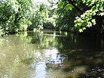
The Duke of Northumberland's River or D. O. N. River consists of separate upper and lower artificial watercourses in west London, United Kingdom. The older name Isleworth Mill Stream/River more accurately describes the economic motivation behind its construction. The first section draws water via a sluice from the Colne — a source river which has seven distributaries, many of which are man-made — today an extended distance (to bypass Heathrow Airport) of about 5 miles (8 km) into the Crane; its lower section of about 1.8 miles (2.9 km) draws water from that small river in Whitton, Twickenham and discharges it via neighbouring Isleworth, passing Mill Plat into the tidal Thames. A sluice underneath Mill Plat feeds the main lake in Syon Park.
Excerpt from the Wikipedia article Duke of Northumberland's River (License: CC BY-SA 3.0, Authors, Images).Duke of Northumberland's River
Bridge Wharf Road, London Isleworth (London Borough of Hounslow)
Geographical coordinates (GPS) Address Nearby Places Show on map
Geographical coordinates (GPS)
| Latitude | Longitude |
|---|---|
| N 51.470555555556 ° | E -0.32194444444444 ° |
Address
Bridge Wharf Road
Bridge Wharf Road
TW7 6BS London, Isleworth (London Borough of Hounslow)
England, United Kingdom
Open on Google Maps


