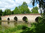
Coldharbour, Surrey
Hamlets in SurreySurrey geography stubs

Coldharbour is a hamlet in the Mole Valley district, in the English county of Surrey. It is on a minor road from Dorking to Leith Hill Place.
Excerpt from the Wikipedia article Coldharbour, Surrey (License: CC BY-SA 3.0, Authors, Images).Coldharbour, Surrey
Wolvens Lane, Mole Valley Capel
Geographical coordinates (GPS) Address Nearby Places Show on map
Geographical coordinates (GPS)
| Latitude | Longitude |
|---|---|
| N 51.185277777778 ° | E -0.35583333333333 ° |
Address
Wolvens Lane
RH5 6HE Mole Valley, Capel
England, United Kingdom
Open on Google Maps


